Defense & Military
Hurricane Hunters: Vital Storm Data Amid Climate Challenges
NOAA’s airborne missions improve hurricane forecasts by 30%, with aging fleets modernizing to meet climate-driven storm intensity. Critical for coastal safety.


The Critical Role of Hurricane Hunters in Modern Meteorology
While satellites scan weather patterns from space, specialized crews risk their lives flying through hurricanes’ violent cores. These Hurricane Hunters provide irreplaceable data that shapes evacuation orders, storm predictions, and our fundamental understanding of tropical cyclones. Since their first daring flight into a 1943 storm near Galveston, these airborne scientists have evolved into a vital component of global weather monitoring systems.
NOAA and U.S. Air Force Reserve teams operate unique aircraft equipped with advanced instrumentation, collecting atmospheric data that satellites can’t capture. With climate change increasing hurricane intensity, their missions have never been more crucial. In 2022 alone, Hurricane Hunter flights contributed to 95% accuracy in 3-day storm track forecasts, potentially saving thousands of lives through early warnings.
Evolution of Hurricane Reconnaissance
The concept of intentional hurricane penetration began as a pilot’s dare in 1943, but quickly demonstrated its strategic value during World War II. By 1946, the military formalized these operations through the 53rd Weather Reconnaissance Squadron. Early flights using repurposed bombers revealed critical details about storm structure that revolutionized meteorologists’ understanding of cyclone dynamics.
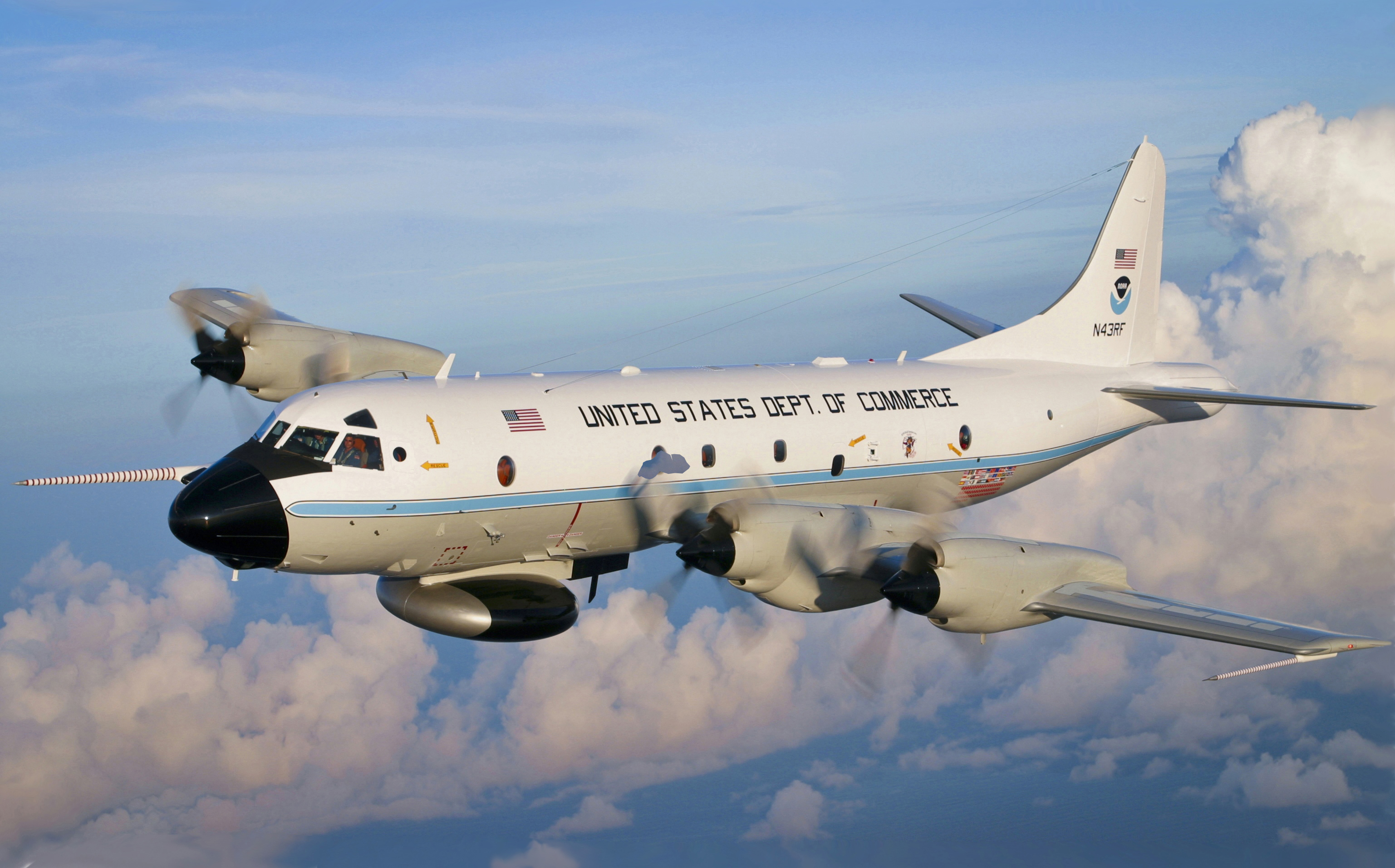
Modern fleets feature specialized aircraft like NOAA’s Lockheed WP-3D Orion turboprops, nicknamed “Kermit” and “Miss Piggy.” These workhorses carry 18-20 scientists and crew on 10-hour missions, deploying 20-30 GPS dropwindsondes per flight. The accompanying Gulfstream IV-SP jet (“Gonzo”) cruises at 45,000 feet, mapping steering currents that determine a storm’s path.
“Flying through a hurricane feels like riding a roller coaster through a car wash,” says NOAA Flight Director Richard Henning. “We’re getting tossed while simultaneously deploying instruments into 150mph winds.”
Cutting-Edge Technology in the Storm’s Eye
Hurricane Hunters employ three primary data collection methods. Tail Doppler radar maps precipitation and wind patterns across 60,000 square miles per mission. Airborne expendable bathythermographs measure ocean temperatures to predict energy transfer to storms. The crucial GPS dropwindsondes radio back pressure, humidity, and wind data during their 15-minute descent to the ocean.
This instrumentation provides real-time insights into developing eye walls and pressure changes. During 2021’s Hurricane Ida, Hunters detected a 15mb pressure drop in 3 hours – critical data that triggered upgraded warnings for Louisiana. Their measurements improved landfall predictions by 22% compared to satellite-only models.
Fleet Challenges in the Climate Change Era
NOAA’s aging WP-3D Orions (average age: 45 years) face unprecedented demands. The 2023 Atlantic season required 40% more flight hours than 2019, accelerating airframe wear. Maintenance costs have doubled since 2015, with planes requiring 400 maintenance hours for every 100 flight hours.
The $670 million WC-130J replacement program aims to address these issues, with new aircraft entering service by 2030. These will carry larger instrument payloads and feature modernized data systems. However, current crews must balance increased mission frequency with safety protocols – 53rd WRS aircraft now average 120 storm penetrations annually versus 85 in 2010.
Future of Hurricane Forecasting
As artificial intelligence transforms meteorology, Hurricane Hunters remain the ground truth for storm models. Recent collaborations with NASA’s CYGNSS satellites demonstrate how aircraft data improves orbital measurements of surface winds. Emerging drone technologies may eventually assist human crews, but can’t yet replicate the precision of manned missions.
The Hurricane Hunters’ evolving mission underscores a crucial reality: despite technological advances, human expertise remains essential in extreme weather monitoring. Their continued operations will shape how coastal communities adapt to intensifying storms in coming decades.
FAQ
Why can’t satellites replace Hurricane Hunters?
Satellites struggle to measure internal pressure and exact wind speeds below cloud tops. Direct measurements from aircraft improve forecast accuracy by 30%.
How dangerous are these missions?
Modern aircraft withstand extreme turbulence, but crews routinely experience +3G/-1G forces. The 53rd WRS has recorded 7 crash fatalities since 1945.
Who uses Hurricane Hunter data?
The National Hurricane Center, FEMA, insurance companies, and global meteorological agencies all depend on their real-time observations.
Sources:
NOAA Hurricane Hunters – Wikipedia,
NOAA Ocean Today,
NOAA Aircraft Operations